Narathiwat is a province in southern Thailand on the eastern side of the Malay Peninsula. It borders Malaysia, with Kelantan on the Malaysian side, and has a coastline on the Gulf of Thailand. Within Thailand, its neighbours include Pattani and Yala. This border setting, together with its forests, rivers and coastal communities, was the subject of the original Personal Thailand article published in October 2007.
This revision keeps that subject and historical setting while expressing the information in clearer English. It is a provincial overview, not a claim that old crossing arrangements, travel times or festival schedules remain available today.
A province between the coast and the Malaysian border
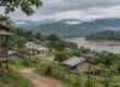
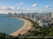
The Narathiwat provincial administration describes a landscape sloping from the forested and mountainous west towards the eastern lowlands and the Gulf of Thailand. Mountains in the southwest form part of the natural boundary between Thailand and Malaysia. Plains lie near the coast and the province’s river systems.
The provincial information page names the Sai Buri, Bang Nara, Tak Bai and Su-ngai Kolok rivers. It also describes extensive peat-swamp areas. Together, these features explain why a description of Narathiwat needs to look beyond a single border town: the province includes inland forests, wetlands and coastal settlements as well as cross-border connections.
The administrative outline in 2007
The original overview listed Mueang Narathiwat, Ra-ngae, Su-ngai Padi, Su-ngai Kolok, Rueso, Yi-ngo, Waeng, Bacho, Tak Bai, Si Sakhon, Sukhirin, Chanae and Cho Ai Rong. It described thirteen divisions, called Cho Ai Rong a subdistrict, and gave a total of 77 communes and 551 villages. These administrative details are retained as the original 2007 description, not a newly verified present-day directory.
Su-ngai Kolok and the border connection
Su-ngai Kolok was a central part of the original article’s description of Narathiwat’s relationship with Malaysia. The Tourism Authority of Thailand also identifies it as an economic and border-tourism centre and the terminus of the southern railway line.
The old article described visitors arriving from Malaysia and Singapore for short holidays and shopping. That is useful historical context for the area’s role, but it should not be read as a current timetable or an assurance that a particular crossing is open. This revision does not repeat the old estimate of a ninety-minute bus journey as dependable travel advice. Crossing arrangements and transport services need their own up-to-date checks.
Places named in the original article
The 2007 overview listed Budo-Su-ngai Padi Mountain Range National Park, Luang Pho Daeng at Wat Choeng Khao, Taloh-manoh Mosque, Ao Manao Park, Ban Thon, Hat Narathat, Khao Kong Buddhist Park and the Phikun Thong Development Study Center. These names are retained as part of its historical account, rather than a promise about present access or opening arrangements.
For orientation, the Tourism Authority of Thailand’s Narathiwat page highlights Narathat Beach, Narathiwat Central Mosque, Khao Kong Buddhist Park, Pa Jo Waterfall and Sirindhorn Peat Swamp Forest. Its selection reflects the province’s mix of coastline, religious landmarks and natural landscapes. It does not by itself establish that every place is accessible on a particular day.
Festivals and provincial identity
The original article mentioned the Chao Mae Tomo celebrations and the Narathiwat Products Fair. They remain part of the historical description here. No current dates or claims of continuing operation have been added: an older festival reference is not a booking calendar.
The original provincial profile also listed the chengal tree, Neobalanocarpus heimii, and the flower Odontadenia macrantha as provincial symbols. Those references are retained from the archive, not presented as a newly researched botanical catalogue.
Reading the overview in its historical context
Narathiwat is not simply a route into Malaysia. Its coastal and inland geography, local communities and border connections all belong to the same provincial story. The original article tried to introduce that setting; clearer wording should preserve it rather than replace it with an unrelated modern itinerary.
For a neighbouring province’s historical overview, see Pattani Province and its Malay Muslim heritage. Neither archive overview is a current security assessment or a substitute for checking official arrangements before travel.
FAQ
Does Narathiwat border Malaysia?
Yes. Narathiwat is a Thai–Malaysian border province on the eastern side of the Malay Peninsula.
Is Narathiwat only an inland border area?
No. It also has a Gulf of Thailand coastline, river plains, peat swamps and forested mountains.
Why does the article mention Su-ngai Kolok?
The town is important to the province’s border connections. The Tourism Authority of Thailand describes it as an economic and border-tourism centre and the end of the southern railway line.
Are the festivals and transport details a current schedule?
No. The original article dates from 2007. Historical event references are retained without asserting that their dates or arrangements remain unchanged.
Sources and editorial scope
Geographical background checked on 6 November 2026 against the Narathiwat provincial administration’s general information and the Tourism Authority of Thailand’s Narathiwat page. This is not a verification of current event dates, border-opening arrangements or travel security.
More from Personal Thailand
If you enjoy practical reporting and personal perspectives on Thailand, you can support my work and explore member-only content through either platform:
- Subscribe to Personal Thailand on X — creator membership with access to applicable subscriber-only posts and benefits.
- Join or support Personal Thailand on Buy Me a Coffee — browse available memberships and support options.
These are separate services with different charges and membership benefits. Paid access may be required; subscribing on one does not automatically grant access on the other. The main information in this article is free to read above.